
Gorge Journal · Land & Title
A land survey on Red River Gorge property is not a formality you order because the lender asked, and Kentucky’s rules for one are stranger and more specific than most buyers expect. The state does not tell you whether to get a survey. It tells your surveyor how accurate the work has to be — and the standard that applies to your parcel is looser than the standard that applies to a lot in town. On Gorge land that difference is not academic. It decides how far your corner can legally sit from where the plat says it is.
Does Kentucky require a survey before you buy land?
Not of the buyer. The state regulates how a boundary survey must be performed and monumented, not whether you choose to order one before closing.
That distinction is the whole ballgame, and it is why “is a survey required in Kentucky” returns such unsatisfying answers. The standards of practice for professional land surveyors are set out at 201 KAR 18:150, published by the Kentucky Legislative Research Commission. The regulation governs the surveyor’s work — research, field work, tolerances, monuments, plats. It does not make the buyer order anything. Note when you read it that the Commission’s page also carries a proposed version of the regulation, so confirm which text is current before relying on a specific line.
Who may do the work is a separate question with a hard answer: boundary surveying in Kentucky is a licensed profession, administered by the Kentucky Board of Licensure for Professional Engineers and Land Surveyors. A neighbor with a good tape measure and a metal detector is not a substitute, however confident he is about the old fence.
What changes when your parcel is classified Rural?
The allowable error roughly doubles. Kentucky sorts every boundary survey into one of two classes, and the looser class is the default for open country.
The regulation classifies a boundary survey for platting or describing a parcel as either Urban or Rural. An Urban survey covers urban or suburban land lying within or adjacent to a city or town limit, a commercial business area, an industrial area, or a residential area outside a city or town limit containing subdivided lots smaller than five acres. A Rural survey, in the regulation’s own words, “shall apply to all land not classified as Urban.” Its table of specifications by class reads:
| Specification | Urban | Rural |
|---|---|---|
| Unadjusted closure (minimum) | 1:10,000 | 1:5,000 |
| Angular closure (maximum) | 15 seconds | 30 seconds |
| Accuracy of distances | +/-0.05′ + 100 PPM | +/-0.10′ + 200 PPM |
| Relative positional accuracy | +/-0.05′ + 100 PPM | +/-0.10′ + 200 PPM |
Here is the part worth carrying into a Gorge purchase. Class is decided by what surrounds the land, not by how much you paid for it. A wooded tract off a county road is Rural. But a three-acre lot inside a developed cabin subdivision can meet the Urban description — a residential area outside a city limit with subdivided lots smaller than five acres — and Urban carries the tighter tolerance. Two neighbors on the same ridge can hold plats produced to different legal standards. If you are comparing lots across subdivisions, this is a real and checkable difference, not a nuance. The same logic runs through how to choose a Red River Gorge subdivision.
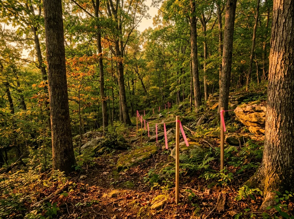
In the Gorge your corner can legally be a tree and your line can legally be a cliff. Both are written into the regulation, and both have rules.
Can a tree really be your property corner?
Yes — but only on a Rural survey, only under stated conditions, and never for more than half the corners on the parcel.
The preferred monument is an iron rod, pipe or pin at least one-half inch in diameter and eighteen inches long, capped with the license number of the surveyor who supervised the work. Where that is not practical the regulation allows a magnetic-locatable alternative such as a mag nail, and beyond that a short list of alternates. Then it addresses trees directly. A tree may be established as a corner monument only on a Rural boundary survey. It must be at least ten inches in diameter at breast height, in sound condition, marked in a manner that is “both physical and permanent” without harming the tree, and described by size, species and method of marking both on the plat and in the written description. Trees “shall not constitute more than fifty (50) percent of the established monuments for a rural boundary survey.” On an Urban retracement where a tree is found to be the monument of record, the tree must be reference-monumented instead.
Read that list as a due-diligence checklist rather than trivia. If your plat calls a corner at a tree, the species and size belong on the plat. If they are not there, you have a question for the surveyor before you have a dispute with a neighbor. And a tree corner is a monument with a biography — it can die, burn, be logged, or be cut by someone who never knew what it was. That is a live risk on ground that has been worked, which is why it pairs with what to check on recently logged Gorge land.
What about a creek, a ridge or a cliff line as the boundary?
The regulation calls those linear monuments, permits them, and then requires physical monuments along them at a set spacing so the line can be found again.
In the regulation’s language, linear monuments “may consist of a watercourse, ridge, road, or cliff.” Where a boundary line intersects one, that point must be monumented or reference-monumented. And a physical feature representing a linear monument must be monumented or reference-monumented “at a minimum of every 1,000 feet,” with those monuments set in intra-visible pairs and spacing between pairs not exceeding 1,000 feet. All monumentation must be set before the plat is issued, and the regulation is explicit that signing and sealing a plat is the surveyor’s certification that all corners shown on it are set on the ground.
In Red River Gorge country this is the ordinary case, not the exception. Cliff lines, drains and ridgelines are what the old descriptions call to, and a modern retracement has to reconcile them with a rule written for the whole state. The result is a plat that can look sparse to a buyer used to suburban lots — and be entirely compliant.
What does a survey not tell you?
Title. The regulation draws that line itself, and it is the single most useful sentence in the document for a buyer.
Record research and field work, the regulation says, shall be used to determine the location of the boundary of the property surveyed, and “shall not be used by a professional land surveyor to determine title.” A surveyor tells you where the line is. Whether you own what is inside it, and what rides along with it, is a title question answered by a different professional reading different documents. The two searches are complementary and neither substitutes for the other — which is exactly why a survey exception on a title commitment deserves a careful read. That mechanic is unpacked in what Schedule B of a title commitment means on Gorge land.
Worth knowing what your surveyor is required to look at: present and relevant historical record descriptions for your parcel and every adjoining parcel, the description of the physical monument representing each corner, other deeds, prior plats and surveys, and other public agency records including tax maps, GIS maps and topographic maps. The adjoiner research is the quiet one. A boundary is a shared thing, and the neighbor’s deed is evidence about your line.
Where do Gorge boundary problems actually come from?
From paper much older than any plat you will be handed — and Kentucky publishes a surprising amount of it for free.
The Kentucky Secretary of State Land Office maintains searchable databases of the state’s original land records, including the Virginia and Old Kentucky Patent Series, Kentucky Land Warrants, County Court Orders, certificates of settlement and preemption warrants, Virginia treasury warrants, and military patents, along with an order form for copies. For a rural eastern Kentucky tract, those are the documents at the bottom of the pile your surveyor is retracing. You can search them yourself before you ever hire anyone — not to do the surveyor’s job, but to know whether the parcel’s paper is simple or complicated before you price the work.
How I handle the survey question on a land purchase
On Gorge land I treat the survey as a timing decision, not a yes-or-no one. The question I ask first is what the existing description is made of: if the parcel was split off a parent tract recently and has a modern plat with described monuments, that is one situation. If the description calls to a beech, a drain and a stone, that is a different one, and it is the second case that wants a surveyor before the inspection period runs out rather than after. The second thing I do is read the plat for what is missing — species and size on a tree corner, a closure statement, the surveyor’s seal — because an incomplete plat is a question, not a defect, and questions get cheaper to ask the earlier you ask them. Acreage almost never turns out to be the real issue. Where the line runs relative to the driveway, the well, the septic field and the building site is the issue, every time.
Frequently asked questions
Can land be sold in Kentucky without a survey?
Yes, and rural Kentucky land frequently is. Nothing in the standards of practice obliges a buyer or seller to order a boundary survey. What it means practically is that the deed description you receive rests on whatever documents came before it, and no one has walked the corners on your behalf.
Does the county GIS or PVA map show my real boundary?
No. The regulation lists tax maps, GIS maps and topographic maps among the records a surveyor must obtain and evaluate as research inputs. They are evidence to be weighed, not a boundary determination. A parcel outline on a county map is an assessment and mapping product, and it can differ materially from a retracement on the ground.
What does the surveyor’s signature and seal on a plat actually certify?
Under the regulation, all monumentation must be set before the plat of survey or record plat is issued, and the signing and sealing of a survey plat is the professional land surveyor’s certification that all corners shown on the plat are set on the ground. That is a meaningful statement, and it is one more reason to read the plat rather than file it.
If you are working through raw land here and want the order of operations rather than a list of worries, start with buying land in the Red River Gorge.
Last updated: September 11, 2026
By Marcos Gil, REALTOR® — Keller Williams Commonwealth · KY Real Estate License No. 296259 · Call or text (859) 310-1209.
Disclosure: I publish Invest in the Gorge and marcosgilrealty.com and also own Central Property Services. This article summarizes a published Kentucky administrative regulation and public state records; it is general information, not legal, surveying or lending advice — I am your agent, not your lender.
Leave a Reply