
Marcos Gil, REALTOR® · Keller Williams Commonwealth

Category: Blog

Your blog category

  • Soil Test Before Buying Land in Kentucky: Which One Counts

    Gorge Journal · Land Due Diligence

    There are two completely different things called a soil test before buying land in Kentucky, and buyers get them confused constantly. One is a laboratory report you get through your county Cooperative Extension office — it tells you about fertility and lime. The other is a site evaluation performed by your local health department — it is the one that decides whether a Red River Gorge parcel can hold a septic system, and therefore whether you can build on it at all.

    Which soil test actually tells you if you can build?

    The local health department’s on-site sewage site evaluation. Nothing else. The extension office soil report is a farming and gardening tool and does not answer the septic question at all.

    Kentucky’s Onsite Sewage Disposal Systems Program, run by the Kentucky Cabinet for Health and Family Services Department for Public Health, states plainly that “the local health department onsite septic system inspectors perform site evaluations and inspections in Kentucky,” and that the program begins with on-site evaluations “to determine if site and soil conditions are suitable for onsite wastewater systems.” That evaluation, not a lab report, is the gate.

    What does the Cooperative Extension soil test measure, then?

    Fertility. It reads the chemistry of your topsoil so you know what to add to grow something in it, and it says nothing about whether the ground can absorb wastewater.

    The University of Kentucky Division of Regulatory Services soil testing program describes its own output as laboratory reports of “soils, plants, irrigation water, soilless media and animal waste with subsequent fertilizer and lime recommendations.” Fertilizer and lime. That is a genuinely useful report if you are planning a pasture, a food plot, an orchard or a garden on Gorge land — and a completely irrelevant one if your question is whether a three-bedroom cabin can be permitted.

    A buyer who walks into the extension office and asks for “a soil test” will get a real, accurate, well-run laboratory report that answers a question they were not asking.

    Extension soil testHealth department site evaluation
    Who performs itUK Division of Regulatory Services lab, sample submitted through your county Extension officeA certified inspector working for the county health department
    What it reportsFertilizer and lime recommendationsWhether site and soil conditions are suitable for an onsite wastewater system, and what system type is required
    Answers “can I build here?”NoYes
    Required for a septic permitNoYes

    How does the site evaluation work in the Gorge counties?

    You apply to the county health department where the land sits, an inspector comes out and evaluates the soil and site, and the result tells you what kind of system the ground will accept — if any.

    Powell County is a fair template for how a Gorge-area county runs it. The Powell County Health Department describes the sequence as: file an application with the health department, after which “a certified inspector will perform a site evaluation and will provide the homeowner with information on the type of system required.” From there the owner plans the system to those specifications, submits the plan for approval, installs only after approval, and calls the inspector back at set stages — the department checks excavated leach lines before they are covered, verifies depth, and performs a final inspection before the system is approved. The office is at 376 North Main Street in Stanton and takes calls at (606) 663-4360. Application and permit fees apply; the department does not publish the amounts online, so ask.

    Wolfe, Lee, Menifee and Estill counties each run the same state program through their own health department. Confirm which county your parcel is actually in before you call — Gorge parcels sit near county lines more often than buyers expect, and a tract with a Campton or Stanton mailing address is not necessarily in the county that address implies.

    Why is this a bigger deal on Gorge land than on flat farmland?

    Because the two things that most often disqualify a conventional septic field — shallow soil over rock and steep slope — are the same two things that make Gorge land beautiful.

    A ridge-top tract with a long view and a hollow below it is exactly the terrain where a site evaluation comes back requiring something other than a standard drain field, or comes back with no suitable area at all. That is not a reason to avoid the region. It is a reason to make the evaluation a contingency rather than a post-closing discovery: the sentence you want in your offer is that closing is contingent on the county health department finding a suitable area for the system your intended structure needs, at your expense, within a defined window.

    A professional observation from working land files: the buyers who get hurt are almost never the ones who asked and got a hard answer. They are the ones who were told by someone on the phone that “there’s septic up there” — meaning a neighbor has one — and treated that as an answer about their parcel. Soil suitability changes across a single tract, sometimes within a hundred feet. A neighbor’s approved system is evidence about the neighbor’s soil.

    What else belongs in the same due-diligence pass?

    Access, title exceptions and any recorded rights running through the land. The septic question is one of four that decide whether a Gorge tract is buildable.

    A parcel that percolates but has no lawful driveway connection is not buildable either — see our notes on driveway permits for Red River Gorge land. A parcel that has both can still carry a recorded easement across the very area your system would need, which is why we walk Schedule B of the title commitment line by line, and why oil, gas and pipeline easements get their own read.

    Can I use the seller’s old soil test?

    Ask the health department, not the seller. An evaluation performed for a different structure, a different system size or a different location on the tract may not transfer to what you intend to build. Treat an old report as a hint about the ground, not as an approval you have inherited.

    Is a “perc test” the same as a site evaluation?

    In everyday speech people use “perc test” for the whole process. In Kentucky the operative step is the health department’s on-site evaluation of site and soil conditions, which determines suitability and the type of system required. Use the health department’s own language when you ask for it, and you will get to the right desk faster.

    What if the evaluation comes back unsuitable for a conventional system?

    That is an answer, not necessarily a dead end. The evaluation is what tells you which system type the ground will accept, and alternatives to a conventional drain field exist. What changes is the cost and the design, which is exactly why you want this answer before you are contractually committed rather than after.

    Last updated: September 5, 2026.

    By Marcos Gil, REALTOR® — Keller Williams Commonwealth · KY Real Estate License No. 296259 · Call or text (859) 310-1209.

    Educational information about land due diligence, not engineering, legal, environmental-health or lending advice — I am a real estate agent, not your lender. Confirm every requirement with the health department for the county your parcel is in before you rely on it. Invest in the Gorge is published by Marcos Gil, who also publishes marcosgilrealty.com and owns Central Property Services; they are separate businesses.

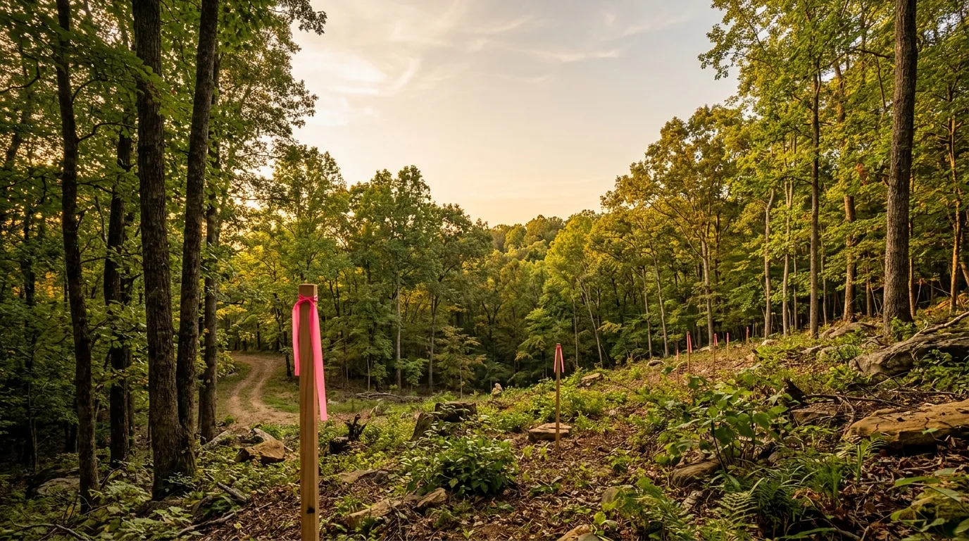
  • Kentucky Fire Hazard Season: Red River Gorge Burn Rules

    Gorge Journal · Land Ownership

    Kentucky’s fall forest fire hazard season opens October 1 and runs through December 15, and for anyone who owns land near the Red River Gorge it changes what is legal on your own property. Kentucky burn laws do not simply discourage burning during that window — they make burning near woodland illegal for twelve hours of every day. If you are clearing a cabin site, burning brush from a new driveway cut, or dealing with storm debris, the calendar matters as much as the weather.

    When is Kentucky’s fall fire hazard season?

    October 1 through December 15. Kentucky also runs a spring season from February 15 through April 30, so roughly five months of the year fall inside a hazard season.

    The Kentucky Division of Forestry publishes both windows on its outdoor burning page: “Spring Forest Fire Hazard Season: Feb. 15 – April 30” and “Fall Forest Fire Hazard Season: Oct. 1 – Dec. 15.” The authority behind them is KRS 149.400, titled “Fire hazard seasons — Fires prohibited — Exceptions” in the Kentucky Revised Statutes.

    The two seasons are not arbitrary. Both sit on either side of the growing season, when leaf litter is cured and on the ground and the canopy is open. In the Gorge that fuel load is significant, and the terrain that makes the property attractive — steep, wooded, hard to reach — is exactly what makes a fire there difficult to stop.

    What can you legally burn during fire hazard season, and when?

    Not within 150 feet of woodland or brushland between 6 a.m. and 6 p.m. Outside those hours, or when the ground is snow-covered, the restriction does not apply.

    The Kentucky Energy and Environment Cabinet states the rule directly: “During fire seasons, it is illegal to burn anything within 150 feet of any woodland or brushland between the hours of 6 a.m. to 6 p.m.” The exception it gives is “between 6 p.m. through 6 a.m., or when the ground is covered with snow.”

    Read that measurement against a Gorge parcel and the practical effect becomes clear. A hundred and fifty feet is not much distance on wooded acreage. On most of the land that sells in Powell, Wolfe, Menifee and Lee counties, there is no point on the property that is more than 150 feet from woodland or brushland. For those parcels the daytime restriction is effectively total for two and a half months this fall — not a setback you can design around, but a schedule you have to work inside.

    On most wooded Gorge acreage there is nowhere on the property that is 150 feet from woodland. The restriction is not a setback. It is a clock.

    Can your county add its own burn ban on top of the state rule?

    Yes. Kentucky law expressly contemplates local bans, so the state season is a floor rather than the whole picture, and a county or city ordinance can be stricter.

    The statute is KRS 149.401, “City or county ordinance banning open burning during fire hazard periods”. That is why “is it legal to burn today?” is a two-part question in the Gorge: what does the state season say, and has the county issued a ban. The Division of Forestry advises checking with your local fire department and county government before any outdoor burning, and that is the right habit — especially if your parcel sits in one county and your mailing address is in another, which happens constantly out here.

    Land that adjoins the national forest carries a third layer. Federal restrictions on campfires and open burning inside the Daniel Boone National Forest are issued separately and change with conditions; the Daniel Boone National Forest alerts page is where the Forest Service posts them. Those orders bind activity on federal ground, not on your deeded acreage, but if your property line is the forest boundary, what happens on one side reaches the other.

    What happens if a fire you set gets away from you?

    Kentucky has two separate cost-recovery mechanisms aimed at the person responsible for a fire — one for firefighting costs and one for damages. Both sit in KRS Chapter 149.

    The chapter includes KRS 149.180, “Collection of costs of firefighting from person responsible for fire — Disposition,” and KRS 149.430, “Liability of violator for state and private damages — Disposition of damages.” A related provision, KRS 149.370, is titled “Acts creating fire hazards in forests prohibited.” The full text of each is on the Legislative Research Commission’s Chapter 149 page, and this is a place to read the statutes yourself rather than take a summary — including this one.

    The exposure is worth understanding before you own the land rather than after. A fire that leaves your property on steep, wooded terrain can involve state suppression resources, private neighbors, and federal ground in the same afternoon.

    What this means if you are buying Gorge land this fall

    Buyers routinely plan the clearing before they plan the closing, and the two calendars collide in October. If your plan for a new parcel involves burning brush — from a driveway cut, a cabin pad, a fence line, or a timber cleanup — the state season has already narrowed your legal window to overnight hours by the time most fall closings fund.

    The workable version is to decide the disposal method before you close, not after. Chipping, hauling, or leaving material to break down are all still available in daylight. Burning is the one that is on a clock. This is the same category of question as how you will legally reach the property and what the recorded documents actually permit — the answers are cheap to get before a contract and expensive to get after. If you are still early, the guide to buying land in the Red River Gorge covers the rest of the diligence sequence, and the Daniel Boone National Forest overview explains what adjoining federal ground means for an owner.

    Frequently asked questions

    Does the fire hazard season ban campfires and grills too?

    The state rule as the Division of Forestry states it applies to burning anything within 150 feet of woodland or brushland during the restricted hours. Because that language is broad and local ordinances and federal forest orders can be stricter, check the county and, if you are near or on national forest ground, the Forest Service alerts before assuming a contained fire is fine.

    Can I burn at night during fire hazard season?

    The Cabinet gives 6 p.m. through 6 a.m. as the exception to the daytime prohibition, along with snow cover. That is the state rule only. A county burn ban can close the overnight window as well, so confirm locally before you light anything.

    Does the season apply on land that is not wooded?

    The restriction is written around proximity — within 150 feet of woodland or brushland — not around what your own parcel is classified as. An open field within 150 feet of a neighboring treeline is inside the rule, which is why measuring from the fire to the nearest woods matters more than looking at your own deed.

    Last updated: September 4, 2026.

    By Marcos Gil, REALTOR® — Keller Williams Commonwealth · KY Real Estate License No. 296259 · Call or text (859) 310-1209.

  • Driveway Permit for Red River Gorge Land: Before You Buy

    Driveway Permit for Red River Gorge Land: Before You Buy

    Gorge Journal · Land & Access

    A driveway permit for Red River Gorge land is not a formality you handle after closing. If the parcel fronts a state route, the Kentucky Transportation Cabinet has to permit the entrance before it is built, and the office that says yes or no to the whole Gorge region sits in one building in Jackson. The road in front of the land decides which authority you are dealing with — and buyers routinely price the gravel without ever asking that question.

    Last updated: September 4, 2026

    Do you need a permit to put a driveway on Gorge land?

    If the land touches a state highway, yes. Kentucky requires a permit for any new access to the state highway system, and for any work on the right of way.

    The Kentucky Transportation Cabinet states it without qualification: “Any firm, individual, or governmental agency that wants access to a road on the state highway system or wants to conduct any type of work activity on the right-of-way, must obtain a permit.” That is published on the Kentucky Transportation Cabinet Permits Branch page, which also lists the permit categories the Cabinet administers.

    The word doing the work in that sentence is access. Not construction, not commercial, not size. Cutting a new entrance where there was not one is access, and access to a state route is permitted, not assumed.

    Which road is in front of the land?

    That single question sorts every Gorge parcel into one of three permitting worlds, and the three are not interchangeable.

    FrontageWho reviews the entranceWhat the buyer is really asking
    Numbered state routeKYTC — the district officeWill the Cabinet permit an entrance here, and where?
    County roadThe county — fiscal court and road departmentIs this road actually county-maintained, and what do they require?
    Private drive, shared gravel, or subdivision roadNo public agency at allWhat does the recorded easement allow, and who maintains it?

    The third row is the one that surprises people, because there is no permit to get and that feels like good news. It is not good news; it means the answer lives in a recorded document instead of a public counter, which is exactly the territory covered in Schedule B of a title commitment on Gorge land. A permit can be applied for. An easement that does not exist cannot be.

    How much Gorge frontage is actually state highway?

    More than most buyers assume — because the region’s signature drive is itself built out of state routes.

    The Forest Service publishes the makeup of the Red River Gorge Scenic Byway: it uses State Highways 77, 715 and 402, with State Highway 11 forming the beginning and ending points, running approximately 46 miles from Stanton to Zachariah, past the Gladie Visitor Center and Nada Tunnel, with portions paralleling the Red River. That description is on the Daniel Boone National Forest page for the Red River Gorge Scenic Byway.

    Lay that over the permitting question and you get a conclusion worth carrying into a showing: the roads that make Gorge land desirable — the scenic frontage, the route people picture themselves driving home on — are largely the same roads that put the entrance under state permit review. The view and the permit requirement arrive together. That is not a reason to avoid byway frontage. It is a reason to ask about the entrance on the first visit rather than the last.

    The frontage that makes Gorge land worth buying is the same frontage that puts your driveway in front of a state reviewer. The view and the permit arrive together.

    Where does a Gorge-region application go?

    To KYTC Highway District 10 in Jackson. One district office covers the entire Red River Gorge region, which makes this a single phone call.

    KYTC publishes District 10 as serving “Breathitt, Estill, Lee, Magoffin, Menifee, Morgan, Owsley, Perry, Powell, and Wolfe” counties, at 473 Highway 15 South, Jackson, KY 41339, (606) 666-8841, KYTC.District10Info@ky.gov, open 8:00 a.m. to 4:30 p.m. EST Monday through Friday. See the KYTC Highway District 10 page.

    Read that county list against the way people describe this market and the overlap is close to total. Powell, Wolfe and Menifee are the Gorge proper. Lee and Estill are the southern and western approaches. Every one of them is District 10. So a buyer comparing three parcels in three different counties is not comparing three bureaucracies — they are all the same office, and one call can cover all three. That is a genuine convenience, and almost nobody uses it, because the district structure is not something a land listing ever mentions.

    The Cabinet’s central office, for reference, is at 200 Mero Street, Frankfort, KY 40622, (502) 564-4556 — but the entrance question belongs to the district.

    What else does the permit cover besides the entrance?

    More than the driveway. KYTC’s published permit categories reach most of what a buyer intends to do at the road edge.

    The Permits Branch lists categories including utility facility installations; permitting of entrances and other correlated roadway modifications; altering or replacing existing drainage facilities; plantings upon the right-of-way; replacement of right-of-way fence; and tree trimming and cutting. The full manual is published as the Kentucky Transportation Cabinet Permits Manual.

    Now read that list as a punch list of things people do in their first month on a new Gorge property: run power in from the road, replace a collapsed culvert, clear the brush choking the view at the entrance, plant something at the mouth of the drive, put up a fence and a gate. Several of those sit on the state’s right of way, which is wider than the pavement, and each one appears on the Cabinet’s own list. The driveway is the item buyers budget for. The other five are the ones that get discovered.

    If you are sequencing a build, this belongs early — the same reasoning applied to timelines in how long it takes to build a cabin in the Red River Gorge.

    What if the access route crosses national forest land?

    Then a second, separate authority is involved, and it is federal. That is a Forest Service question, not a KYTC question.

    Gorge parcels are frequently bounded by or interleaved with the Daniel Boone National Forest, and a state entrance permit says nothing about crossing federal ground. I am not going to summarise the federal process here, because I would be guessing at the specifics and that is worse than saying nothing. The point for a buyer is structural: confirm early whether the only workable route to a building site touches national forest land, because if it does, you have two agencies to satisfy and only one of them answers the phone in Jackson.

    What this changes on a land walk

    The habit I would encourage on any Gorge land showing is to stand at the road before you walk the property, not after. Look at where a driveway could physically go given the bank, the ditch line and the curve, and notice whether that place is the same place you would want it. On steep frontage those are often two different spots, and the difference between them is the whole conversation. Then find out what road you are standing on. Everything downstream — which office, which form, which timeline, and whether there is any public office at all — follows from that one fact, and it costs nothing to establish. Access questions of this kind sit alongside the survey and easement work covered in access roads, easements and surveys for Gorge property.

    This is general information drawn from published agency sources, not legal or engineering advice. Permit outcomes turn on site-specific facts, and the district office is the authority on its own roads.

    Frequently asked questions

    How do I tell whether my frontage is a state route or a county road?

    The reliable answer comes from the road authority, not from the listing or the map app. For the Gorge region, KYTC Highway District 10 in Jackson covers Breathitt, Estill, Lee, Magoffin, Menifee, Morgan, Owsley, Perry, Powell and Wolfe counties and can be reached at (606) 666-8841 or KYTC.District10Info@ky.gov. If the road is not on the state system, the county road department is the next call.

    Does an existing gravel pull-off count as an approved entrance?

    Not necessarily, and that is worth verifying rather than assuming. KYTC’s published rule is that access to a road on the state highway system requires a permit; whether a particular existing cut was ever permitted, and whether it is permitted for the use you intend, is a question for the district office. Two things people treat as one — a place a truck can pull off, and a permitted entrance — are not the same thing.

    Should the entrance question be settled before closing?

    It should at least be asked before closing. A permit is discretionary and site-specific, so no one can promise an outcome in advance — but establishing which authority governs the frontage, and whether a workable entrance location exists on the parcel, is free and can be done during the inspection period. That is the difference between buying a known question and buying an unknown one.

    By Marcos Gil, REALTOR® — Keller Williams Commonwealth · KY Real Estate License No. 296259 · Call or text (859) 310-1209.

    Disclosure: Invest in the Gorge is published by Marcos Gil, who also owns Central Property Services and publishes marcosgilrealty.com and forsalelexingtonky.com.

  • Conservation Easements on Red River Gorge Land

    Conservation Easements on Red River Gorge Land

    Gorge Journal · Land Due Diligence

    A conservation easement on Kentucky land is a permanent restriction that stays with the parcel after you buy it, after you sell it, and after everyone involved in creating it is gone. If you are looking at acreage near the Red River Gorge with a cabin site in mind, this is one of the few things you can discover in an afternoon that can quietly rule out the entire plan — and one of the few that will not show up in a listing photo.

    What is a conservation easement, in plain terms?

    It is a recorded agreement in which a landowner permanently gives up certain development rights on a parcel while keeping ownership of the land itself. A separate organization holds and enforces the restriction.

    The Kentucky Natural Lands Trust, one of the organizations that holds easements in this state, describes them as “flexible, private, permanent” and states that with one in place “landowners maintain ownership of the land,” with the agreement itself specifying the restricted and permitted uses. That is the whole shape of the thing: you still own it, you still pay taxes on it, you can still sell it — but a defined list of things can no longer be done on it, by you or by anyone who owns it after you.

    Kentucky recognizes these by statute. The Farmland Information Center, run by American Farmland Trust, identifies Kentucky’s conservation easement enabling statutes as KRS 382.800 to 382.860. Those sections sit inside Chapter 382 — the chapter on conveyances and encumbrances, which is where the state puts things that attach to title.

    Why does the statute make a conservation easement findable?

    Because Kentucky makes recording part of how one is created. The section governing creation is titled, in the statute book itself, “Creation — Acceptance and recordation necessary — Duration — Preexisting property interest.”

    Read that heading slowly, because it is the most useful sentence in this whole subject for a buyer. You can see the section titles for KRS 382.800 through 382.860 on the Legislative Research Commission’s Chapter 382 page. The one at 382.810 puts “acceptance and recordation necessary” directly into the creation requirements.

    The practical translation: a validly created conservation easement in Kentucky is a recorded instrument. It is in the county clerk’s records. It is not a handshake, not an understanding among neighbors, not something a seller can honestly forget about. Which means the question “does this parcel carry one?” has an answer that exists on paper before you close — and the reason buyers get surprised is almost never that the document was hidden. It is that nobody read the title work carefully enough to notice it.

    A conservation easement is not a risk you discover. It is a document you either read or you didn’t.

    Where would a conservation easement show up when I buy Gorge land?

    In Schedule B of your title commitment, listed as an exception, usually as a recorded deed of conservation easement with a book and page number. That book-and-page reference is the thing to chase.

    A title commitment does not summarize what an exception means. It tells you an instrument exists and where it is recorded. A conservation easement on a hundred-acre tract and a five-foot utility easement along the road frontage can look almost identical in that list — a line of text and a citation. One of them is irrelevant to your cabin plan and one of them may end it. We walk through how to read that document in detail in what Schedule B of a title commitment actually tells you.

    So the sequence is: find the exception, pull the recorded instrument from the county clerk in the county where the land sits — Powell, Wolfe, Lee, Menifee, Estill depending on where in the Gorge region you are looking — and read the restrictions and permitted uses. Not a summary of them. The document.

    What should I actually be looking for in the document?

    The permitted-uses section, and specifically whether it allows a residence, where, how large, and whether that right has already been used up by an existing structure.

    What to look forWhy it decides your plan
    Whether a dwelling is permitted at allSome easements reserve a building right; others extinguish it entirely
    How many dwellings, and whether one already existsA reserved right that has been exercised is spent
    A designated building envelope or homestead areaYou may be able to build, but only in a spot chosen decades ago
    Limits on subdivisionKills a split-and-sell exit even if it does not affect your own cabin
    Restrictions on commercial useDirectly relevant if the plan involves short-term rental income
    Road, utility and clearing limitsDetermines whether a permitted site is actually reachable and serviceable
    Who holds the easement, and notice requirementsTells you whose written consent you will need, and for what

    A general craft observation, offered as craft and not as any particular transaction: land buyers reliably underestimate how much of a parcel’s value lives in documents rather than in dirt. People will drive out three times to stand on a ridge and look at the view, and spend twenty minutes on the paperwork that determines whether they are allowed to put anything on that ridge. Recorded restrictions are cheap to check and expensive to discover late, and unlike a soil problem or a road problem there is no engineering your way out of one. A conservation easement is negotiated with a holder or it is not moved at all. That asymmetry is the reason it belongs at the front of a due-diligence list rather than the back.

    Is a conservation easement always a bad thing for a buyer?

    No. It is a bad surprise. For a buyer whose plan is a single cabin on a large, permanently wild tract, an easement on the surrounding land can be the reason the setting stays what it is.

    The Gorge region’s appeal is not manufactured — it comes from the fact that a great deal of the land around it is not going to change. Permanent protection on a neighboring tract is the closest thing to a guarantee that the view from a porch stays the view from that porch. Some buyers actively want an easement on their own land for that reason, and for the tax treatment that can come with donating one, which is a conversation for a CPA and an attorney rather than for me.

    What makes it bad is buying it unknowingly. The restriction is permanent and the price you paid is not refundable against it.

    If you are earlier in the process than title work, the wider checklist is in our guide to buying land in the Red River Gorge, and the companion piece on mineral and timber rights covers the other family of recorded interests that can be severed from a Gorge parcel without any of it being visible on the ground. Your county’s UK Cooperative Extension office is also a genuinely useful, free first call on land and forestry questions in this part of the state.

    Frequently asked questions

    Can a conservation easement be removed if I buy the land?

    Treat it as permanent. Kentucky Natural Lands Trust describes conservation easements as permanent, and the statutory scheme in KRS 382.800 to 382.860 addresses duration directly. Any change involves the holder of the easement and, depending on the instrument, other parties as well. Never buy on the assumption that you will be able to undo one.

    Will a conservation easement stop me from renting the cabin short-term?

    It depends entirely on what the recorded document says about commercial use and residential occupancy. Some easements are silent on it, some restrict commercial activity broadly. There is no general answer — this one has to be read out of the instrument itself, and local short-term rental rules apply on top of it regardless.

    How do I find out whether a specific parcel has one before I make an offer?

    The complete answer comes from the title commitment, which you normally get after a contract. Before that, a search of the county clerk’s recorded documents against the current owner’s name and the deed reference will usually surface a recorded conservation easement, because recording is part of how one is created in Kentucky. Ask the listing side directly as well, in writing.

    This is general information about recorded property interests, not legal or tax advice. Have a Kentucky real estate attorney read any conservation easement affecting land you are buying.

    Last updated: September 3, 2026.

    By Marcos Gil, REALTOR® — Keller Williams Commonwealth · KY Real Estate License No. 296259 · Call or text (859) 310-1209.

  • Kentucky Wild Rivers Act: Buying Land on the Red River

    Gorge Journal · Land & Investment

    The Kentucky Wild Rivers Act protects a specific stretch of the Red River, and the land alongside it sits under a set of use rules most listings never mention. Search this topic and you get the state’s program page, a brochure, an advocacy group and some very good photographs. What you do not get is the only version a land buyer needs: what you can build, what you can cut, what needs a permit, and how anyone is supposed to know whether a parcel is inside the line at all.

    Does the Kentucky Wild Rivers Act cover the Red River?

    Yes. The Red River is one of nine designated streams, and the protected segment runs from the Ky. 746 bridge downstream to the mouth of Swift Camp Creek.

    That segment is named in the statute itself. KRS 146.241, which designates the streams in the system, lists at subsection (2) “The Red River from the Ky. 746 bridge to the mouth of Swift Camp Creek.”

    The same subsection carries a fossil of Kentucky history: nothing in the Act “shall be construed to prohibit that portion of the Red River between Peck’s Branch and Swift Camp Creek from being used to temporarily contain flood waters that may be impounded above the normal sustained pool level of any lake which may be created in the event a dam is constructed on the Red River near Bowen, Kentucky.” The dam was never built. The sentence is still in the statute.

    The administrative regulation adds the access points. 400 KAR 4:100, Section 2, sets the upper access point at “the area where Ky. 746 crosses the Red River” and the lower access point at “the area where Ky. 715 crosses the river.” Access points and the designated segment are two different things — do not read one as the other.

    How far from the water does the corridor reach?

    At least the visual horizon of the stream, and never more than 2,000 feet from the center of it. Where the line actually falls is drawn on a map, not written in the rule.

    400 KAR 4:100’s own necessity statement puts it plainly: KRS 146.250 “directs the Secretary to determine generally the boundaries of the Wild Rivers,” and “the boundaries must include at least the visual horizon of the stream but not extend more than 2,000 feet from the center of the stream.”

    Read that as a range, not a number. Two thousand feet is the ceiling, not the width. In cliff country the visual horizon can be reached in a few hundred feet; in an open bottom it can run much further. Two neighbouring tracts on the same river mile can sit on opposite sides of the boundary.

    How do you find out whether a particular parcel is inside the boundary?

    You request the map. The regulation adopts the boundaries by reference to a map it does not reproduce, and tells you exactly where to write for a copy.

    This is the single most useful line in the whole regulation and it is buried in the certification statement. The boundaries of each stream area are “delineated on the map captioned ‘Designated Wild River Area, Red River,’ which map is hereby adopted and incorporated herein by reference.” The maps “are incorporated by reference as they are too large and cumbersome for reproduction,” and “copies of the maps are available by request from the Nature Preserves Commission, 300 Sower Boulevard, Frankfort, Kentucky 40601.”

    So there is no way to answer the boundary question from the text of the law. Not from the statute, not from the regulation, and not from a listing description. The answer lives on a sheet of paper in Frankfort, and it is free to ask for.

    The boundary that decides everything here is on a map the regulation does not print.

    What can you still do on land inside a wild river corridor?

    More than owners expect. Ordinary maintenance, gardening, fencing, firewood cutting for family use and existing lawful uses are all treated as conforming, with two limits.

    400 KAR 4:125, the administration regulation, lists conforming uses at Section 3. They include “the routine maintenance, repair, renovation or replacement of existing roads, buildings, or other structures or improvements to an existing use”; “the selective cutting of firewood or individual trees by a landowner for personal or family use”; “landscaping and gardening, including flower, fruit, and vegetable production”; and fencing.

    Then comes the test that decides most real cases. Section 3(4): other land uses qualify as conforming “if they do not involve the clearing of more than one-half (1/2) acre of timber, nor constitute a significant visual intrusion within 100 feet of the river.”

    Half an acre of clearing, and a hundred feet of river frontage. Those two numbers are the practical shape of a building envelope on corridor land, and they are worth having in mind before you fall in love with a view.

    Section 3(1) also preserves what is already there: under KRS 146.290, land uses lawfully existing when the boundaries were designated “may continue even though the use does not conform to the purpose and intent of the Kentucky Wild Rivers Act or the management plan.”

    What needs a permit, and what is prohibited outright?

    Selective timber cutting and larger agricultural clearing need a change-of-use permit. Surface mining, non-selective timber harvest and in-stream work are prohibited entirely.

    ActivityStatus inside the corridorSource
    Resource removal other than surface miningChange-of-use permit required400 KAR 4:125 §4(2)(a)
    Selective cutting of timberChange-of-use permit required400 KAR 4:125 §4(2)(b)
    New agricultural use clearing more than ½ acre of timberChange-of-use permit required400 KAR 4:125 §4(2)(c)
    Clearing diseased or insect-infested trees over ½ acreWritten authorization, on a professional forester’s recommendation400 KAR 4:125 §3(4)(f)
    Transmission line or pipeline right-of-wayWritten approval required before construction begins400 KAR 4:125
    Surface mining; timber harvest by methods other than selective cutting; in-stream disturbancesProhibited400 KAR 4:125 §5(1)
    Dam construction, dredging, spoil or fill deposition, channel diversion, channelization, mining of streambed materialsProhibited as in-stream disturbances400 KAR 4:125 §5(2)
    Roads, buildings or other structures for a use that is not existing or permittedProhibited400 KAR 4:125 §5(3)
    New permanent roadsNot constructed except as authorized by the office400 KAR 4:125

    Two of those rows connect to questions we have already worked through on this site. The utility right-of-way rule sits directly on top of the private easement problem covered in our note on oil, gas and pipeline easements on Red River Gorge land — a recorded easement is one permission, and approval to build inside a wild river corridor is a second, separate one. The timber rows do the same to mineral and timber rights on Gorge land: owning the timber and being allowed to harvest it are not the same question inside the corridor.

    Does the designation let the public onto private riverfront?

    No. Public use is limited to public waters and public lands, or to interests a landowner has voluntarily granted. Using private property still requires the owner’s permission.

    This is the fear that comes up first whenever the words “wild river” appear in a listing, and Section 6 of 400 KAR 4:125 answers it directly. Public use “shall be limited to the public waters and public lands or interests in lands acquired through lease, easement, or other agreement entered into by the landowner. Public use of private property shall require permission from the landowner. Trespassing shall be subject to penalty as established in KRS 146.990.”

    The regulation goes further and puts the burden on the state: the office “shall make every effort to inform the public that the wild river designation does not authorize public use of privately owned lands and shall prepare maps delineating the boundaries of public lands within wild river corridors to reduce unintentional trespassing.”

    How much of this binds a private owner?

    That is the honest open question, and the regulation’s own scope sentence is the reason it is open. Ask the office before you buy, not after.

    400 KAR 4:125 states that it “shall apply to all lands and waters under state jurisdiction that are located within designated wild river boundaries as established in 400 KAR 4:100,” and adds that nothing in it “shall be construed as superseding any requirements of other cabinet programs or of other state or federal agencies.” Meanwhile the permitted-use and prohibited-use sections are written in terms of activity within the corridor, and Section 6 speaks about private land explicitly.

    Working land questions in this area, the pattern that keeps proving itself is that the cheap phone call always beats the confident assumption. A boundary map request and one conversation with the office that administers the program cost nothing and take days; discovering after closing that your building envelope is a half acre and a hundred feet off the water costs a great deal more. Ask before the inspection period ends, and ask in writing so the answer is part of your file — the same reason we treat Schedule B of the title commitment as reading material rather than paperwork.

    Is the Red River’s wild river designation the same as the national Wild and Scenic Rivers System?

    No. They are separate systems. The Kentucky Wild Rivers System is a state program created under KRS 146.220 to 146.360, with streams designated in KRS 146.241 and boundaries set by 400 KAR 4:100. Federal Wild and Scenic designation is a separate federal framework with its own administration. A river can be in one, the other, or both, and the rules that apply to your parcel depend on which applies where you are.

    Can I still cut firewood on my own land inside the corridor?

    400 KAR 4:125 Section 3 lists “the selective cutting of firewood or individual trees by a landowner for personal or family use” as a conforming use, which does not require a change-of-use permit. Selective cutting of timber as a broader activity is listed separately at Section 4 as requiring a change-of-use permit, so the line runs between personal and family use and a timber operation.

    Does a wild river corridor stop me from building a cabin?

    Not automatically, but it constrains where and how. Under Section 5(3), construction of roads, buildings or other structures “to effect any use other than an existing or permitted land use” is prohibited, and Section 3(4) treats clearing more than half an acre of timber or creating a significant visual intrusion within 100 feet of the river as taking a use outside the conforming category. Confirm your parcel’s position against the official boundary map and speak to the office before you plan a build.

    Last updated: September 2, 2026

    This is general information about Kentucky’s wild rivers program for land buyers, not legal advice. Whether a specific parcel falls inside a designated boundary, and what that means for a specific plan, should be confirmed with the administering office and your attorney before you close.

    By Marcos Gil, REALTOR® — Keller Williams Commonwealth · KY Real Estate License No. 296259 · Call or text (859) 310-1209.

  • Oil, Gas and Pipeline Easements on Red River Gorge Land

    Gorge Journal · Land & Title

    An oil, gas or pipeline easement on Red River Gorge land is not a rare exotic finding. Kentucky is one of the most densely drilled states in the country, the state’s own well database now carries more than 162,000 mapped well locations, and gathering lines cross private ground all over eastern Kentucky. The question on a Gorge parcel is almost never “is there anything?” — it is “where is it, who has the right to reach it, and does that right sit exactly where I want to put the cabin?”

    This post is the practical follow-on to two earlier ones: the note on mineral and timber rights on Red River Gorge land, which covers who owns what beneath the surface, and the walk-through of Schedule B of a title commitment, which is where recorded easements actually appear. This one is about the access rights themselves — the lines and roads that let somebody else’s mineral interest reach the surface of your land.

    How many oil and gas wells are actually mapped in Kentucky?

    162,157 well locations, as of the state geological survey’s most recent monthly data release. That is the mapped, permitted population — not an estimate, and not the total number of holes ever drilled.

    The count and the update date are published by the Kentucky Geological Survey, which states that its Kentucky Oil and Gas Well Location Shapefile was updated August 28, 2026, contains 162,157 well locations, is updated monthly, and is derived from the Kentucky Division of Oil and Gas permitting process.

    Two things follow from that sentence, and both matter to a buyer. First, the data is good and it is current — a monthly refresh on a statewide layer is unusually well maintained for a free public dataset. Second, and less comfortable: it is derived from the permitting process. A well that predates modern permitting, or a hole that was never permitted, is not in it. Absence from the map is not proof of absence from the ground.

    Where do you check for wells before you write an offer?

    Start with the Kentucky Geological Survey’s oil and gas well search, which lets you query by geography and returns well records with their locations plotted on a map.

    The search is free and it is the same underlying data the state uses. You can look up wells against a parcel’s rough location before you have spent a dollar on diligence, and the records link through to permit numbers, depths and, in many cases, scanned well logs. On a Gorge tract this is a fifteen-minute check that can reframe an entire purchase.

    The KGS oil and gas well record search is published by the Kentucky Geological Survey at the University of Kentucky, and the permitting programme behind the data is run by the Kentucky Division of Oil and Gas within the Energy and Environment Cabinet.

    The well is the easy part. It is a dot on a public map. The pipeline that carries what the well produces is the part nobody checks — and it is the part that runs across your building site.

    What is a gathering line, and why is it the harder problem?

    A gathering line is the small-diameter pipeline that carries oil or gas from the wellhead to a larger transmission system. It is the one most likely to cross a rural parcel, and the one least likely to be visible.

    Kentucky does publish a gathering-lines layer. Here is the part a buyer needs to know before leaning on it: as of August 31, 2026 the Kentucky Geological Survey’s download page lists the data behind its Kentucky Oil and Gas Gathering Lines Shapefile — supplied to KGS by the Kentucky Division of Oil and Gas — as last updated July 31, 2025. The well layer sitting directly beside it on the same page was refreshed on August 28, 2026 — thirteen months later.

    Both update dates are published side by side on the Kentucky Geological Survey oil and gas data downloads page, which gives “Data last updated: July 31, 2025” for the gathering lines shapefile and “Data last updated: August 28, 2026” for the well location shapefile.

    That is a thirteen-month gap between two datasets sitting on the same page, and it is exactly the kind of detail that gets lost when somebody says “I checked the state maps.” You did — but the two layers you checked are not the same age, and the older one is the one describing the thing buried in your ground.

    KGS layerData last updatedWhat it does and does not tell you
    Oil and Gas Well Location ShapefileAugust 28, 2026162,157 permitted well locations statewide; derived from the permitting process, so unpermitted or pre-permitting holes are absent
    Permitted Deviated Oil and Gas TracesAugust 29, 20264,802 deviated well traces and 8,227 inflection points; KGS states these are only deviated wells reviewed for permitting, and are not as-built lines
    Oil and Gas Gathering Lines ShapefileJuly 31, 2025Supplied to KGS by the Kentucky Division of Oil and Gas; the oldest of the three, and the one that describes pipe crossing private land

    Do the state’s maps show the line where it was actually laid?

    Not necessarily, and the Kentucky Geological Survey says so plainly for its deviated-well layer: those traces cover only deviated wells reviewed by KGS for permitting, and they are not as-built lines.

    That distinction — permitted route versus as-built route — is the whole ballgame on a narrow Gorge building envelope. A line permitted to run along one edge of a hollow and actually laid thirty feet over is still legally within its easement in most cases, but thirty feet is the difference between a buildable bench and an unbuildable one. Public mapping tells you a line is probably there. It does not tell you where the pipe is.

    For the actual position, the free tool is a locate request. Kentucky’s one-call system exists precisely so that operators come out and mark buried facilities before anybody excavates, and a locate is worth running before you finalise a driveway cut, a septic field or a foundation on land you already suspect has pipe under it.

    Kentucky’s statewide one-call notification service for locating buried utilities is Kentucky 811.

    Where does the easement itself actually live?

    In the county clerk’s recorded land records, and — if it has been picked up — on Schedule B of your title commitment. The map layers show infrastructure. The easement is a document.

    These are two separate searches and they fail in opposite directions. A recorded easement may exist with no line ever built under it, which is a live right somebody can still exercise. A line may exist whose easement is old, vaguely described by metes and bounds that reference a fence long gone, or granted in a severed mineral conveyance from decades ago. Neither situation is unusual on eastern Kentucky acreage, and neither is discoverable from a listing photo.

    This is also where the mineral-rights question and the easement question converge. If the minerals under a Gorge tract were severed from the surface generations ago, the mineral owner generally holds some right of reasonable surface access to reach them — and that right can exist whether or not any specific easement has ever been recorded describing it. The mineral and timber rights post covers the severance question itself in more depth.

    How I work through this on Gorge land

    The order I have found works is cheapest-first, because the cheap checks eliminate most parcels before anyone pays for anything. The KGS well search costs nothing and takes minutes, so it goes first, on the rough location, before the parcel is even under contract. If wells show up on or immediately around the tract, the gathering-line question is live by definition and the title work needs to be read with that in mind rather than skimmed.

    Then the sequence is documents, then ground. Schedule B first, in full, with every exception actually pulled and read rather than listed. Then, on anything that survives to a real building plan, a locate before the excavator arrives. The mistake I watch buyers make is doing that last step in the right order but too late — after the site plan is fixed and the only remaining option is to pay to move the plan. On a wide-open tract that is an annoyance. On a Gorge parcel where the buildable area is a bench between a cliff line and a creek, it can be the whole deal. If you are still choosing where to buy, the note on choosing a Red River Gorge subdivision covers how platted developments handle utility corridors differently from raw acreage.

    Common questions

    If the state map shows no wells on the parcel, is it clear?

    No. The Kentucky Geological Survey states that its well location shapefile is derived from the Kentucky Division of Oil and Gas permitting process. Wells drilled before modern permitting, or never permitted, would not appear. A clean map result is a good sign and a real narrowing of risk, but it is not a title opinion and it is not a substitute for reading the recorded records.

    Can I have an existing pipeline easement removed or moved?

    That is a question for a Kentucky real estate attorney on the specific recorded instrument, and the honest answer is that it depends entirely on what the easement document says and what rights it granted. Some easements are precisely described and narrow; some are broad and old. What I can tell you as an agent is that this is a question to answer during a due-diligence period, not after closing, because the answer can change what the land is worth to you.

    Does an oil or gas easement stop me building a cabin?

    Usually it constrains where rather than whether. An easement typically reserves a corridor and a right of access to it, which removes that corridor from your buildable area and can affect driveway routing and septic siting. On a large flat tract that may cost you nothing. On a narrow Gorge parcel where the buildable bench is already limited, the same corridor can be decisive. The only way to know is to locate the corridor on the actual ground and lay your site plan against it.


    Last updated: August 31, 2026.

    By Marcos Gil, REALTOR® — Keller Williams Commonwealth · KY Real Estate License No. 296259 · Call or text (859) 310-1209.

  • Kentucky Agricultural Assessment and Red River Gorge Land

    Gorge Journal · Land & Taxes

    Kentucky’s agricultural assessment lets qualifying land be taxed on its farm use value instead of its market value — and the statute that defines it turns on acreage and actual use, not on what you paid. That distinction matters more in the Red River Gorge than almost anywhere else in the state, because Gorge land routinely sells for reasons that have nothing to do with farming.

    Buyers ask me about this constantly and usually in the wrong form: “does the farm exemption transfer?” It is not an exemption and it does not transfer like a warranty. It is a valuation method, applied per parcel, against tests written into the Kentucky Revised Statutes. Here is what those tests actually say.

    What does Kentucky law count as agricultural land?

    At least ten contiguous acres used to produce livestock, poultry, or crops including timber. Aquaculture qualifies at five contiguous acres, and land enrolled in a state or federal agriculture program qualifies on that basis.

    Those thresholds come straight from the definitions chapter of Kentucky’s property tax law. As published by the Kentucky Legislative Research Commission, KRS 132.010(9) defines “agricultural land” as any tract, including all income-producing improvements, “of at least ten (10) contiguous acres in area used for the production of livestock, livestock products, poultry, poultry products and/or the growing of tobacco and/or other crops including timber”; a tract “of at least five (5) contiguous acres in area commercially used for aquaculture”; or a tract devoted to and qualifying for payments under a state or federal agriculture program.

    Two words in that text do real work for Gorge buyers. Contiguous means the acreage has to hold together — a ten-acre total assembled from two separated parcels is not the same thing as ten contiguous acres. And timber is named explicitly as a qualifying crop, which matters on wooded Gorge tracts where nothing that looks like conventional farming is happening. If you are working through what standing timber on your tract is and is not, our note on mineral and timber rights on Red River Gorge land covers the ownership side of that question.

    What about smaller tracts — is five acres ever enough?

    Yes, but under a different definition. Horticultural land qualifies at five contiguous acres when it is commercially used for growing — a garden, an orchard, fruit or nut production, vegetables, flowers, or ornamental plants.

    The operative word there is commercially. KRS 132.010(10) sets the five-acre horticultural threshold for land “commercially used for the cultivation of a garden, orchard, or the raising of fruits or nuts, vegetables, flowers, or ornamental plants.” A large personal vegetable garden behind a cabin is not what that sentence describes. This is the point where a lot of Gorge buyers talk themselves into an expectation the statute does not support.

    Statutory categoryMinimum contiguous acreageRequired use
    Agricultural land10 acresLivestock, livestock products, poultry, poultry products, tobacco, or other crops including timber
    Agricultural land (aquaculture)5 acresCommercial aquaculture
    Agricultural land (program)No acreage statedDevoted to and qualifying for payments under a state or federal agriculture program agreement
    Horticultural land5 acresCommercial cultivation of garden, orchard, fruits or nuts, vegetables, flowers, or ornamental plants
    Thresholds as defined in KRS 132.010(9) and 132.010(10). The Property Valuation Administrator for the county, not the seller and not me, decides whether a given parcel meets them.

    Why does what you paid for the land not set the farm value?

    Because the statute tells the assessor to exclude exactly the kind of sale that dominates the Gorge market. Farm use value is built from sales where the price reflects farm use — not sales driven by access, views, or expansion.

    KRS 132.010(11), also published by the Kentucky Legislative Research Commission, defines agricultural or horticultural value as use value “based upon income-producing capability and comparable sales of farmland purchased for farm purposes where the price is indicative of farm use value, excluding sales representing purchases for farm expansion, better accessibility, and other factors which inflate the purchase price beyond farm use value.”

    The premium a cliff-line view commands is, in the statute’s own language, a factor that inflates the purchase price beyond farm use value — which is precisely why it does not follow the land into the farm assessment.

    That clause is the whole reason the agricultural assessment exists as a concept: without it, a working farm next to a subdivision would be taxed as though it were the subdivision. In the Gorge the same logic runs in a direction buyers do not expect. A recreational buyer paying a view premium has not established a higher farm value for the neighbourhood; they have created precisely the sort of comparable the statute instructs the assessor to set aside.

    Which parcel characteristics does the statute actually weigh?

    Seven of them, listed in the statute itself. Three come up on nearly every Gorge tract I walk, and they are the three that most often surprise a buyer coming from outside the region.

    • Relative percentages of tillable land, pasture land, and woodland. Gorge tracts skew heavily to woodland, and the mix is what gets weighed — not the total.
    • Degree of productivity of the soil. Thin ridge soil and bottomland behave very differently here, sometimes on the same parcel.
    • Risk of flooding. Named directly in the statute. If you have been through the flood question already, our note on flood zones and property insurance in the Red River Gorge covers the insurance half; this is the assessment half of the same physical fact.
    • Improvements to and on the land that relate to the production of income — fencing, water, working structures, not a cabin’s finishes.
    • Row crop capability, including allotted crops other than tobacco.
    • Accessibility to all-weather roads and markets. On steep Gorge access this is rarely a formality.
    • Factors affecting general agricultural conditions for the taxable unit.

    Read that list next to a typical Gorge listing and the mismatch is obvious. The characteristics that make a tract desirable to a cabin buyer — elevation, seclusion, a view, a hard-won driveway — are close to orthogonal to the ones the statute weighs. A parcel can be excellent as a homesite and unremarkable as agricultural land, and both things can be true on the same deed.

    How should a buyer handle this before closing?

    Treat the current assessment as information about the seller’s use, not a feature of the property you are buying. Then ask the county PVA how the parcel is presently classified and what a change of use would mean.

    Here is the professional habit I would pass on, and it is general craft rather than any one transaction: I ask what the land is doing before I ask what it is worth. A tract carrying an agricultural assessment is telling you something about how it has been used, and that history shows up in fencing, in access, in whether anyone has cut timber recently, and in what the neighbours run. That reading is useful whether or not the assessment survives your purchase — and it is a better use of an afternoon than arguing about tax classification with a seller who does not control the answer either.

    Two practical stops. The county Property Valuation Administrator determines classification, and the application is filed per parcel. And for the use question underneath it — what this ground can actually grow or carry — the Lee County Cooperative Extension Service, part of the University of Kentucky’s statewide extension system, is the right first call; every Kentucky county has an office, and soil testing runs through them. If livestock is what you have in mind, our note on Red River Gorge land for horses works through the carrying-capacity side.

    One boundary on all of the above: I am a real estate agent, not a tax adviser or an attorney. This is an explanation of what the statute says, not advice about your return. The PVA classifies, and a CPA or attorney should price the consequences for your situation.

    Common questions

    Does the agricultural assessment automatically continue after I buy?

    Do not assume it does. The classification rests on the land meeting the statutory acreage and use tests, and the county PVA administers that per parcel. A change in use after closing is exactly the circumstance that puts a classification back in question. Ask the PVA for the parcel’s current status in writing before you close rather than inferring it from the seller’s tax bill.

    My tract is nine acres. Is there any path to agricultural classification?

    Not under the ten-acre agricultural test, which requires at least ten contiguous acres. Two other doors exist in the statute: five contiguous acres commercially used for aquaculture, or five contiguous acres commercially used for horticulture as defined in KRS 132.010(10). Both require genuine commercial use, not intent. Whether a specific operation qualifies is the PVA’s determination.

    Does woodland count, or do I need cleared farmland?

    KRS 132.010(9) names timber among the qualifying crops, and KRS 132.010(11) lists the relative percentage of woodland among the factors weighed in determining agricultural value. So woodland is squarely inside the statutory scheme rather than outside it. That is not the same as saying any wooded tract qualifies — the acreage threshold and the production-use test still have to be met.


    Last updated: August 30, 2026.

    By Marcos Gil, REALTOR® — Keller Williams Commonwealth · KY Real Estate License No. 296259 · Call or text (859) 310-1209.

  • Red River Gorge Land for Horses: What to Check First

    Gorge Journal · Land & Acreage

    Buying land for horses in the Red River Gorge is an arithmetic problem before it is a romance. The listing says ten acres; the University of Kentucky says one mature horse needs two to three acres of managed pasture. Those two numbers only agree if the ten acres is open, gently sloped and grazeable — and in Lee, Powell, Wolfe and Menifee counties, a great deal of it is wooded ridge and hillside instead. This is the check to run before you fall for the view.

    How Many Acres Do You Need Per Horse?

    University of Kentucky Cooperative Extension puts it at two to three acres of managed pasture for one mature horse — with managed being the load-bearing word in that sentence.

    The exact wording from University of Kentucky Cooperative Extension, in Improving Kentucky Horse Pastures by Chris D. Teutsch, Krista L. Lea, R.J. Coleman and S. Ray Smith: “On average, one mature horse will require 2-3 acres of managed pasture.” The publication is blunt about what happens below that: less land means overgrazing, weed pressure and bare ground, and the alternative is confining horses to stalls or a sacrifice area rather than pretending the grass will keep up.

    Why Gorge Acreage and Pasture Acreage Are Not the Same Number

    Total acres is what you buy. Grazeable acres is what feeds a horse. In this region the gap between the two is often most of the parcel.

    Land around the Gorge tends to come in a recognizable shape: a strip of bottom or a bench that is genuinely flat, then slope, then timber. Timber is worth money and worth keeping — that is a separate conversation covered in timber and mineral rights on Gorge land — but it is not pasture, and steep ground that gets grazed anyway turns into erosion and mud in a wet Kentucky spring. When you tour a tract, the number to write down is not the deeded acreage. It is how many acres you could actually mow.

    Ten deeded acres and three grazeable acres are the same listing and two completely different farms.

    Does Ten Acres Get You an Agricultural Assessment?

    Ten contiguous acres is the statutory threshold, but the threshold is about use, not about ownership — and the ground around your house does not count toward it.

    Kentucky’s agricultural value assessment is applied for on Form 62A351, published by the Kentucky Department of Revenue. The form quotes KRS 132.010(9): agricultural land means “any tract of land, including all income-producing improvements, of at least ten (10) contiguous acres in area used for the production of livestock, livestock products, poultry, poultry products and/or the growing of tobacco and/or other crops including timber.”

    Two details on that form catch buyers out:

    What the form asksWhy it matters to you
    Line 2 — acreage used in connection with the owner’s dwelling houseReported separately from farm acreage; lawns, drives and family recreation areas are not part of the agricultural calculation
    Application filed with the local county PVA office, one per parcelIf you buy two adjoining tracts, that is two applications, not one
    Source: Kentucky Department of Revenue Form 62A351.

    Whether a given parcel and a given use qualify is the PVA’s call, not mine and not the seller’s. Ask the county PVA before you build a budget on it. Lee County’s market context is laid out in more detail on our Lee County, Kentucky real estate page.

    What to Test Before You Commit

    Soil, water and access — in that order, and all three before the offer rather than after.

    The same UK publication tells you how the soil test is taken: pastures should be sampled to a depth of three to four inches with a soil probe. Every county in the region has its own Cooperative Extension office that handles this — Lee County Cooperative Extension Service, and equivalents in Powell, Wolfe and Menifee counties. It is the cheapest diligence available on a land purchase and almost nobody does it before closing.

    Timing is worth knowing too, because it is seasonal and it is now: UK’s recommended pasture seeding window is late August to early September, drilling 30 to 40 pounds of seed in two directions. A tract bought in October is a tract you cannot properly seed until the following year — which is a real carrying cost if you were planning to move horses onto it in spring.

    What I Look At on a Walk-Through

    After enough land showings in this part of Kentucky you stop looking at the acreage figure first. I look at where water sits after rain, because that tells you more about drainage than any map does. I look at whether a truck and trailer can actually turn around, since a road that works for a car does not necessarily work for a two-horse trailer in February. I look at fence lines against the topography, because fencing a slope costs differently than fencing a flat. And I look at whether the flat ground is the same ground the house would want to sit on — it usually is, and you cannot use it twice. Flood exposure is its own separate check, covered in flood zones and Gorge property insurance.

    Questions Buyers Ask

    Can I keep one horse on five acres in the Gorge?

    Possibly — UK’s guidance is two to three acres of managed pasture per mature horse, so five acres is enough on paper for one. The question is how much of those five acres is open and grazeable rather than wooded slope. Walk it before you assume.

    Does hay ground count toward the ten contiguous acres?

    KRS 132.010(9) as quoted on Form 62A351 covers land used for the production of livestock, livestock products, poultry, poultry products, tobacco and other crops including timber. How your specific use is classified is a determination for the county PVA, and the form asks you to describe the current agricultural use in your own words.

    Should I get the soil tested before or after closing?

    Before, if your inspection period allows it and the seller permits access. A soil test through the county Extension office is inexpensive relative to what it tells you about lime and fertility needs on ground you are planning to graze.

    Last updated: August 28, 2026

    By Marcos Gil, REALTOR® — Keller Williams Commonwealth · KY Real Estate License No. 296259 · Call or text (859) 310-1209.

  • Schedule B of a Title Commitment: Red River Gorge Land

    Gorge Journal · Land & Title

    Schedule B of a title commitment is the part of the document that decides what you are actually buying, and on Red River Gorge land it is rarely short. Schedule A tells you the property and the policy amount. Schedule B tells you everything the title company will not insure — and on raw Eastern Kentucky acreage that list routinely includes severed minerals, roads that cross someone else’s ground, and instruments recorded decades before the current owner was on title. An exception is not a warning label. It is a hole in your coverage.

    What is Schedule B of a title commitment?

    Schedule B is the section listing requirements you must satisfy before closing and the exceptions the title policy will not cover. Anything listed there stays your problem after closing.

    It usually arrives in two parts. Part I is the requirements — the things that must happen for the policy to issue, such as a deed being executed and recorded, a payoff being made, or an estate matter being resolved. Part II is the exceptions, and that is the half that follows you home. Every easement, mineral reservation, right-of-way, lease and restrictive covenant listed in Part II is expressly carved out of your coverage. If one of them later prevents you from building where you planned, the policy does not respond, because the policy told you about it in advance and declined to insure it.

    Most explanations of this stop right there, at the definition. That is not the useful part. The useful part is knowing which exceptions show up on Gorge land specifically, and what each one does to a cabin plan.

    Why does Schedule B matter more on Gorge land than on a subdivision lot?

    Because platted subdivision lots have short, modern chains of title. Gorge acreage often carries a century of severances, leases and hand-drawn access arrangements that were never cleaned up.

    Eastern Kentucky’s land records reflect the region’s history. Mineral estates were severed from surface estates generations ago and never rejoined. Timber was sold separately. Gas and oil leases were signed, recorded, and in some cases never formally released even after production stopped. Roads were established by use and habit across ridges and hollows long before anyone drew a plat. None of that is unusual here, and none of it is a defect in the ordinary sense — it is simply the recorded history of the parcel, and Schedule B is where it surfaces.

    A buyer coming from a suburban closing is used to a Schedule B with four generic exceptions on it. A buyer closing on twelve wooded acres in Wolfe or Lee County may see a dozen specific ones, each referencing a deed book and page. The length is not a red flag by itself. Ignoring it is.

    I covered the mineral and timber side of this in more depth in the piece on mineral and timber rights on Red River Gorge land, and the access side in the page on access roads and easements in the Gorge.

    What shows up on Schedule B for Red River Gorge land?

    Six categories account for most of it. Each one has a different consequence, and only some of them are worth walking away over.

    Exception you may seeWhat it actually meansWhat to do about it
    Reservation of coal, oil, gas and other mineralsSomeone else owns what is under you, and may hold surface rights to reach itPull the referenced deed and read the surface-use language, not just the reservation
    Oil or gas lease of recordA lease may still encumber the tract even if nothing has been produced for yearsAsk whether a release was ever recorded; an unreleased lease is still an exception
    Right-of-way or roadway easementA third party has a recorded right to cross the landLocate it on the ground against your intended cabin site and driveway
    Rights of others in a shared or unnamed access roadYour access may depend on an arrangement that is not exclusiveEstablish in writing who maintains it and who may use it
    Utility easementsLines and poles have a corridor you cannot build inGet the width, not just the existence
    Matters a survey would discloseThe company is excepting boundary and encroachment issues entirelyOrder a survey — this exception is the reason surveys exist

    An exception is not a disclosure the title company is making to be helpful. It is the precise boundary of what they are willing to stand behind.

    How do you check a Schedule B exception in Kentucky?

    You read the underlying instrument. Every exception cites a deed book and page, and those records sit in the county clerk’s office of the county where the land is located.

    Kentucky’s recording rules are what make this workable. Under KRS 382.110, instruments required to be recorded in order to be effectual against purchasers without notice, or against creditors, are to be recorded in the county clerk’s office of the county in which the property — or the greater part of it — is located. That is why a Gorge parcel straddling a county line deserves an extra question, and why “the county clerk’s office” is a specific place rather than a general idea. The same statute contains a detail most buyers have never heard of: a clerk may not admit a deed conveying an interest equal to or greater than a life estate unless the deed plainly specifies the immediate source from which the grantor derived title. Kentucky deeds are supposed to tell you where the grantor’s title came from — which gives you a thread to pull.

    The recording provisions are published by the Commonwealth in the Kentucky Revised Statutes, Chapter 382 (Conveyances), where KRS 382.110 sets out the place of recording and the source-of-title requirement. Verified on the Legislative Research Commission’s site on August 27, 2026.

    One Gorge-specific wrinkle deserves its own sentence: a great deal of land here adjoins federal ground. If your tract borders the Daniel Boone National Forest, the boundary itself, and any access that crosses federal land, is not something a title policy resolves for you.

    Ownership and boundary information for the surrounding federal land is published by the U.S. Forest Service for the Daniel Boone National Forest, verified on August 27, 2026. If your access route touches forest land, that is a Forest Service question before it is a title question.

    A note from working land deals

    In my experience the buyers who get hurt on Schedule B are not the ones who never read it. They are the ones who read it, saw a list of book-and-page citations, decided it looked standard, and moved on. The exceptions on raw land are not boilerplate — the boilerplate ones are usually at the top, and the specific ones that matter are buried in the middle with a deed reference and no explanation. My habit is simple and unglamorous: for every exception with a book and page number, get the actual instrument and read it before the inspection period closes. On a Gorge tract that is often an afternoon of work. It is the cheapest afternoon in the entire transaction, and it is the one that occasionally changes the answer.

    If you are earlier in the process than a title commitment, the groundwork is laid out on our guide to buying land in the Red River Gorge.

    Can exceptions be removed from Schedule B before closing?

    Sometimes. Some exceptions are removed once a requirement in Part I is satisfied, and some standard exceptions can be addressed when a current survey or an affidavit is provided. Others — a recorded mineral reservation, for example — are simply facts about the parcel and will not come off. Ask your closing attorney or title company which category each exception falls into, in writing, rather than assuming the list is fixed or assuming it is negotiable.

    Does a long Schedule B mean I should walk away from a Gorge property?

    Not by itself. Length reflects the recorded history of the tract, and older rural acreage simply has more history than a modern subdivision lot. What matters is whether any single exception conflicts with what you intend to do — build in a particular spot, run a driveway on a particular line, or rely on a particular access route. A short Schedule B with one bad easement is worse than a long one with none.

    Who orders the title commitment, and when should I read Schedule B?

    The commitment is typically ordered once the property is under contract, through the closing attorney or title company handling the transaction. Read Schedule B the day it arrives, not the week of closing. The instruments it references take time to pull and read, and any question you want answered needs to happen inside your inspection or due-diligence period while you still have the ability to act on the answer.


    Last updated: August 27, 2026

    This article is general information about reading a title commitment, not legal advice. Title questions on a specific parcel belong with a Kentucky closing attorney or title company.

    By Marcos Gil, REALTOR® — Keller Williams Commonwealth · KY Real Estate License No. 296259 · Call or text (859) 310-1209.

  • How Long to Build a Cabin in the Red River Gorge

    Gorge Journal · Building & Land

    How long it takes to build a cabin in the Red River Gorge is decided mostly before a single wall goes up. Search this question and you get answers written by log-home kit companies describing framing schedules. That is the wrong half of the problem. On a Gorge parcel the schedule is set by septic suitability, driveway access, power distance and flood determination — and those are county questions, not construction questions.

    What actually controls the timeline?

    Four site conditions control it: whether the soil will pass for septic, whether a legal driveway can reach the build site, how far power has to run, and whether any of the parcel is in a mapped floodplain.

    A kit manufacturer can quote you a shell-erection time because that part is standardised. Nothing about a Gorge parcel is standardised. Two lots on the same ridge road can differ by many months purely because one perked and one did not, or because one had a buildable approach off the county road and the other needed cut-and-fill on a slope. This is the single biggest reason the national “how long to build a cabin” answers do not transfer to Powell, Wolfe, Menifee or Lee County.

    The framing schedule is the predictable part. The septic answer is the part that moves your move-in date by a season.

    What is the right order of operations?

    Confirm septic feasibility first, then access, then utilities, then flood status — and only then commit to a design and a builder.

    Buyers routinely reverse this. They fall for a plan, order it, and then discover the site will not support the bedroom count that plan assumes. Septic capacity is tied to bedrooms, so a failed or downgraded soil evaluation can force a redesign after you have already paid for one. Sequence protects you from paying twice.

    StepWhy it gates everything after it
    Soil evaluation / septic feasibilityDetermines whether you can build at all, and how many bedrooms
    Legal, buildable accessA site you cannot reach with a concrete truck is not yet a build site
    Utility distanceLong service extensions add cost and scheduling dependency on the utility
    Floodplain determinationChanges design, elevation requirements and insurance
    Permits and licensed tradesStatewide construction standards and licensed plumbers/electricians apply
    ConstructionThe only genuinely schedulable phase

    Who do you actually call in each county?

    Your county’s health department handles the septic evaluation, the county handles access and addressing, and the state handles building standards and trade licensing.

    Kentucky’s Department of Housing, Buildings and Construction states that it enforces statewide standards for building construction and licenses or certifies plumbers, electricians, boiler contractors, sprinkler and fire alarm contractors, and building inspectors — so the trades on your job are regulated at state level regardless of which Gorge county you build in. For background on how onsite wastewater systems work before you talk to the health department, the US EPA publishes a public guide to septic systems. Flood status should be checked against the official maps at the FEMA Flood Map Service Center rather than a listing description.

    For county-level questions and local contacts, each Gorge county runs a UK Cooperative Extension office: Powell County Extension, Wolfe County Extension, Menifee County Extension and Lee County Extension. Parcel and ownership records for Powell County are published through the Powell County PVA. If your parcel adjoins public land, the Daniel Boone National Forest is the managing agency for the surrounding federal ground. All of these were reachable on August 26, 2026.

    Why won’t anyone give you a number of months?

    Because an honest number requires your parcel, your county’s current workload, and your design — and any figure quoted without those three is marketing, not a schedule.

    I would rather tell you what determines the answer than invent one. What I can say is that the buyers who finish closest to their expected date are the ones who ordered the soil evaluation early, confirmed access in writing, and asked the utility about service distance before closing on the land — not after. The ones who slip are almost always waiting on an approval they did not know was in the chain.

    How does this interact with your budget?

    Time and cost move together here: a long driveway, a long power run and an engineered septic system are simultaneously the biggest schedule risks and the biggest budget risks.

    That is why the site-work line is the one to interrogate hardest in any estimate. We break the money side down separately on our cost to build a cabin in the Red River Gorge page. If flood exposure is part of your picture, our post on Red River Gorge flood zones and property insurance covers what that changes. And if you are still choosing where to buy, how to choose a Red River Gorge subdivision deals with restrictions and shared roads, which affect access. Buying raw land instead? Mineral and timber rights are worth checking in the same title review.

    Can I start building before the septic is approved?

    You should not plan around it. The septic evaluation determines whether the site supports a residence and how many bedrooms it supports, which feeds directly into the design. Starting design or ordering a package before that answer is how buyers end up paying for a second set of plans.

    Does a kit or prefab cabin build faster in the Gorge?

    The shell may go up faster, but the shell was never the bottleneck. Site work, septic, access and utility connection happen on the same schedule either way. A kit compresses the phase that was already predictable and does nothing to the phases that are not.

    What should I check before I buy the land?

    Septic feasibility, legal and physical access, distance to power, and flood status on the official FEMA maps. Those four decide whether the parcel is buildable and roughly how long it will take. Get them answered during your inspection period, not after closing. I’m your agent, not your lender or your builder — but I can tell you which of those four is likely to be the problem on a given parcel.


    Last updated: August 26, 2026

    By Marcos Gil, REALTOR® — Keller Williams Commonwealth · KY Real Estate License No. 296259 · Call or text (859) 310-1209.